GIS Courses
GIS courses cover mapping, spatial analysis, and geospatial data management, providing insights into how location affects various phenomena. You can learn to create detailed maps, analyze geographic patterns, and visualize data effectively. Topics may include remote sensing, cartography techniques, and using tools like ArcGIS and QGIS to manipulate and present spatial information.
Popular GIS Courses and Certifications

University of California, Davis
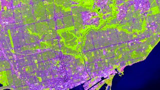
University of Toronto
Skills you'll gain: ArcGIS, GIS Software, Spatial Data Analysis, Spatial Analysis, Geographic Information Systems, Datamaps, Geospatial Mapping, Data Mapping, Data Manipulation, Data Compilation, Data Processing, Typography, Data Storytelling, Design Elements And Principles
University of California, Davis
Skills you'll gain: ArcGIS, Spatial Data Analysis, GIS Software, Spatial Analysis, Data Storytelling, Geographic Information Systems, Datamaps, Data Presentation, Geospatial Mapping, Data Sharing, Public Health, Land Management, Heat Maps, Image Analysis, Project Management, Data Quality, Metadata Management, Network Analysis, Data Mapping, Data Modeling
University of Michigan
Skills you'll gain: Sustainable Development, Geographic Information Systems, Geospatial Mapping, Spatial Data Analysis, Datamaps, Spatial Analysis, Data Storytelling, Data Visualization, Trend Analysis
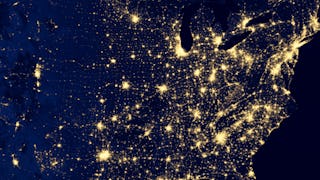
Skills you'll gain: GIS Software, Model Evaluation, Geographic Information Systems, Extract, Transform, Load, Spatial Analysis, Spatial Data Analysis, Geospatial Mapping, Data Pipelines, Geospatial Information and Technology, Apache Airflow, Geostatistics, Interactive Data Visualization, Cloud Computing, Leaflet (Software), Google Cloud Platform, Environmental Monitoring, Model Training, Real Time Data, Pandas (Python Package), Python Programming
What brings you to Coursera today?
University of Toronto
Skills you'll gain: ArcGIS, GIS Software, Geographic Information Systems, Spatial Analysis, Data Mapping

University of California, Davis
Skills you'll gain: ArcGIS, Data Storytelling, GIS Software, Spatial Data Analysis, Data Presentation, Geographic Information Systems, Spatial Analysis, Geospatial Mapping, Heat Maps, Network Analysis, Data Manipulation, Network Routing

Skills you'll gain: Spatial Data Analysis, Geographic Information Systems, GIS Software, Spatial Analysis, Geospatial Mapping, Metadata Management, Verification And Validation, Geostatistics, Data Validation, Query Languages, Technical Documentation, SQL, Data Import/Export, Data Analysis, Data Quality, PostgreSQL, Geospatial Information and Technology, Virtual Environment, Automation, Python Programming
Icahn School of Medicine at Mount Sinai
Skills you'll gain: Geographic Information Systems, ArcGIS, GIS Software, Spatial Data Analysis, Geospatial Information and Technology, Spatial Analysis, Geospatial Mapping, Epidemiology, Public Health, Data Mapping, Analysis, Environmental Engineering
University of Toronto
Skills you'll gain: Geographic Information Systems, GIS Software, Spatial Analysis, Spatial Data Analysis, Data Manipulation

Skills you'll gain: Spatial Data Analysis, Spatial Analysis, Random Forest Algorithm, Model Evaluation, Feature Engineering, Model Training, Matplotlib, Geospatial Information and Technology, Convolutional Neural Networks, Image Analysis, Applied Machine Learning, Plot (Graphics), Supervised Learning, Environmental Monitoring, Trend Analysis, Data Analysis, Geospatial Mapping, Deep Learning, Machine Learning, Geographic Information Systems


University of California, Davis
Skills you'll gain: ArcGIS, Geographic Information Systems, Public Health, Land Management, Geospatial Mapping, Spatial Analysis, Spatial Data Analysis, Social Determinants Of Health, Emergency Response, Business Development, Market Analysis, Risk Mitigation
How to choose the right GIS course
Start with what you want to focus on. If you're interested in environmental mapping, check for courses covering remote sensing and spatial analysis techniques. If you want to use ArcGIS for urban planning, choose courses that provide practical training in ArcGIS software and its applications. Compare the course details to find the best fit for your needs.
Best GIS courses from University of California, Davis
Top-rated GIS courses offered by University of California, Davis on Coursera.
- Fundamentals of GISUniversity of California, DavisBeginnerUniversity of California, Davis
- Geographic Information Systems (GIS)University of California, DavisBeginner3 - 6 MonthsUniversity of California, Davis
- Geospatial Analysis with ArcGISUniversity of California, DavisIntermediate1 - 4 WeeksUniversity of California, Davis
Best GIS certificate programs
Earn a certificate in GIS from top universities and companies.
- GIS, Mapping, and Spatial AnalysisUniversity of TorontoBeginner3 - 6 MonthsSpecialization
- Mastering Geospatial Data Science: From Beginner to ExpertCourseraBeginner3 - 6 MonthsSpecialization
- Geospatial Foundations & Python ToolingCourseraBeginner3 - 6 MonthsSpecialization
Best GIS courses for beginners
Top-rated beginner-friendly GIS courses with no prerequisites.
- GIS: Geographic Information Systems for SustainabilityUniversity of MichiganBeginner1 - 4 WeeksNo prerequisites
- Introduction to GIS MappingUniversity of TorontoBeginner1 - 3 MonthsNo prerequisites
- GIS Fundamentals for Public Health ResearchIcahn School of Medicine at Mount SinaiBeginner1 - 4 WeeksNo prerequisites